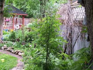


The Garden season is over so I though i'd just post some random pics of my very unique garden.
Its in no way professionally landscaped, I basically planted in a trial and error state of mind....
What do you think?
This is My Blog... And its the daily ramblings about my simple life. Cooking, gardening, children, husband, music, dancing. Just life...


 I'm sorry to those who actually check out my blog....
| TRAIL STATS | |
| LENGTH: | 11 km |
| DIFFICULTY: | ••• |
| ACTIVITIES: | Hiking & Walking, Geocaching |
| CHARACTER: | Natural |
| SURFACE: | Rock, Clay |
| AMENITIES: | Limited roadside parking, Lunch spot at Quarry near waypoint (005) |
| OTHER: | |
| LOCATION | |
| REGION: | Central Ontario |
| SUB-REGION: | Golden Horseshoe |
| CLOSEST TOWN(S): | Cheltenham |